DAY 1: LEMOSHO GATE – MTI MKUBWA CAMP: 4.8km /3mi | 3-4 hrs | Rainforest
Elevation: 2389m/7838ft to 2785m/9137ft
Altitude gained: 396m
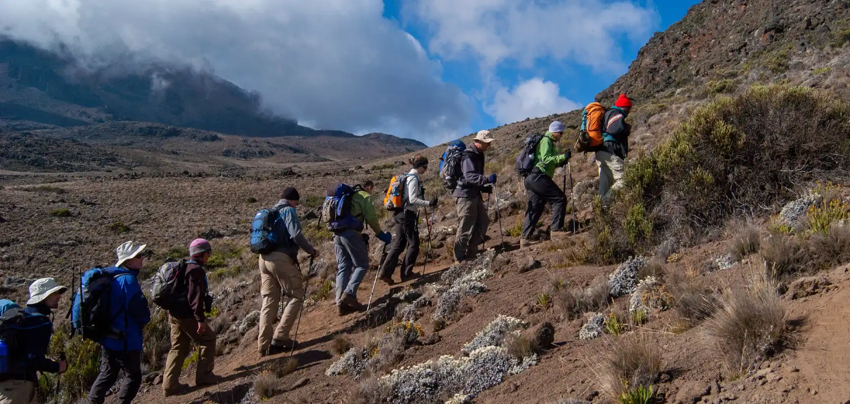
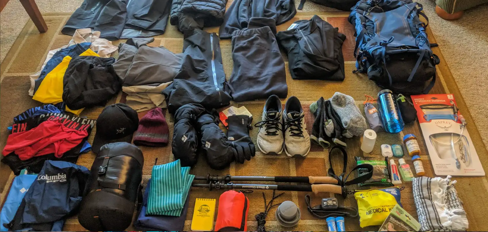
Departing from Moshi a 3 hours drive will take you through welcoming mountainside villages to the Kilimanjaro National Park Gate. We will patiently wait for our permits to be issued while watching the hustle and bustle of operations as many crews prepare for the journey ahead Enjoy the beautiful rainforest scenery and windy trails while your guide tells you about the local flora and fauna and natural wildlife. At these lower elevations, the trail can be muddy and quite slippery. We highly recommend gaiters and trekking poles here.
DAY 2: MTI MKUBWA CAMP – SHIRA I CAMP: 17km/5mi | 6-8hrs | Moorland
Elevation: 2785m/9137ft to 3895m/12,779ft
Altitude gained: 1110m
After a good nights sleep and a hearty breakfast, we emerge from the rain forest and continue on an ascending path, we leave the forest behind now, the trail climbs steadily with wide views to reach the rim of the Shira Plateau. Temperatures begin to drop.
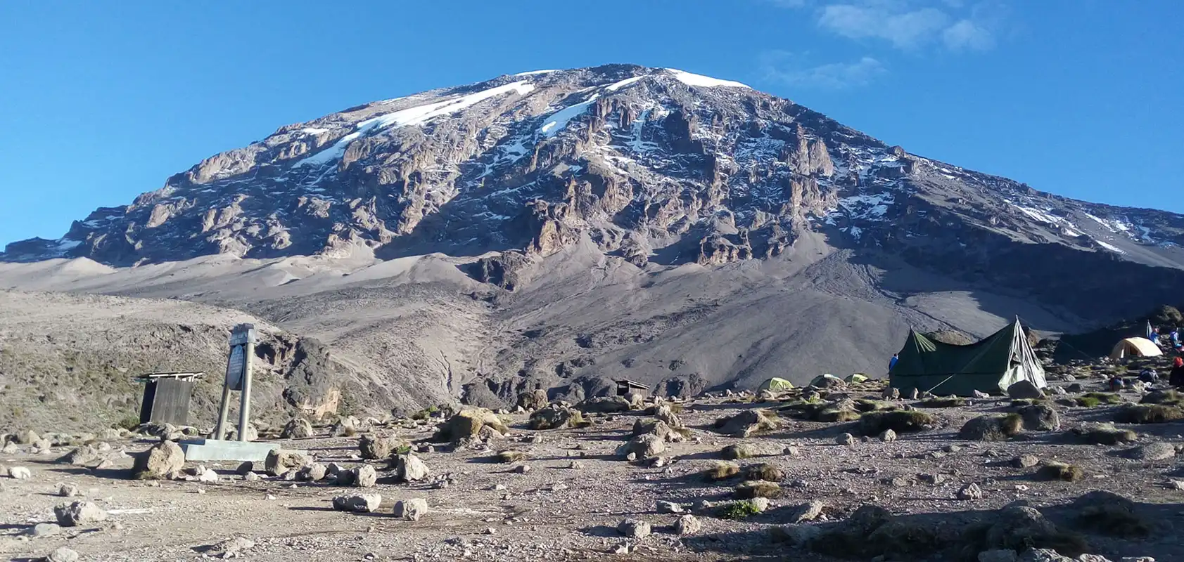
DAY 3: SHIRA CAMP – LAVA TOWER – BARRANCO CAMP: 10.75km/6mi | 5-6hrs | Semi-Desert
Elevation: 3839m/12,595ft to 3986m/13,077ft
Altitude gained: 147m
Although you end the day around the same elevation as when you began, this day is very important for acclimatization. From Shira Plateau we continue east up a ridge, passing the junction towards the Kibo peak before we then continue, South East towards the Lava Tower, called the “Shark’s Tooth” (elev. 4650m/15,250ft). Shortly after the tower, we come to a second junction, which leads to the Arrow Glacier. We then continue to descend to overnight at Barranco Camp.
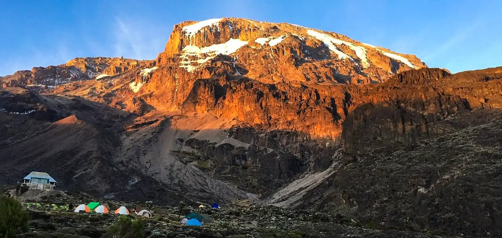
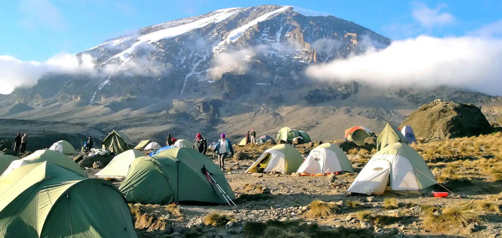
DAY 4: BARRANCO CAMP – KARANGA CAMP: 5.2km/3mi | 4-5hrs | Alpine Desert
Elevation: 3986m/13,077ft to 4034m/13,253ft
Altitude gained: 48m
After breakfast, we continue on a steep ridge up to the adventurous Barranco Wall to the Karanga Valley and the junction, which connects, with the Mweka Trail. This is one of the most impressive days to see the power, agility, and strength of your crew zip over this wall with what appears such ease. Overnight at Karanga Camp.
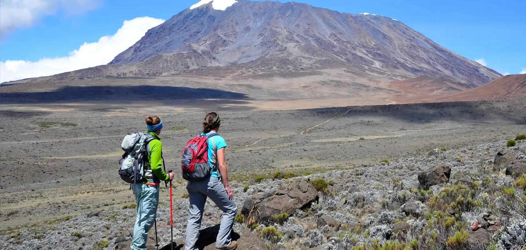
DAY 5: HIKE KARANGA CAMP – BARAFU CAMP: 3.3km /2 mi | 4-5hrs | Alpine Desert
Elevation: 4034m/13,253ft to 4662m/15,295ft
Altitude gained: 628m
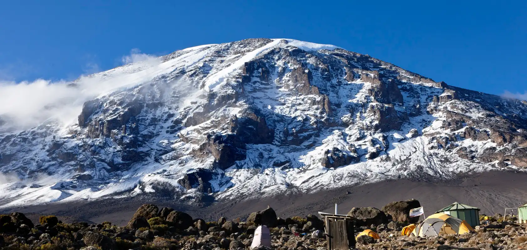
We continue up toward Barafu Camp, and once reached you have now completed the South Circuit, which offers a variety of breathtaking views of the summit from many different angles. An early dinner and rest as we prepare for summit night. Overnight at Barafu Camp.
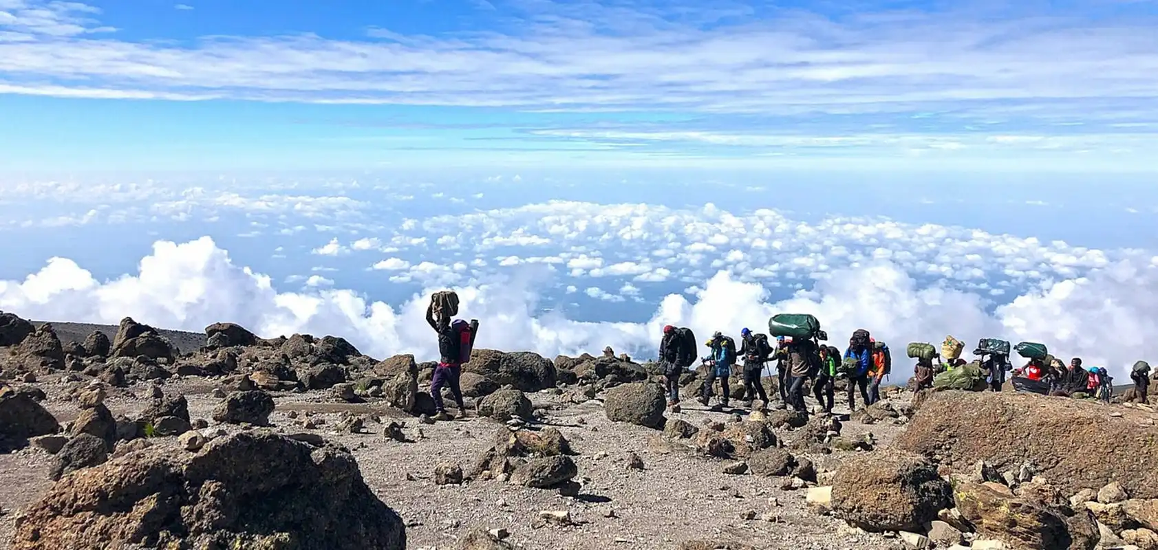
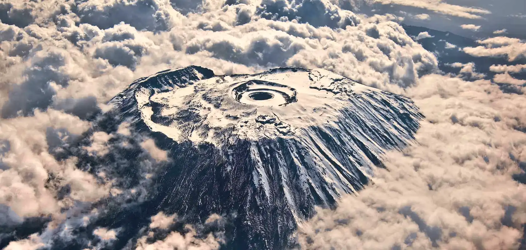
DAY 6: BARAFU CAMP – SUMMIT: 5km /3mi up | 5-7hrs | – MWEKA CAMP: 11.5km /8mi down | 5-6hrs | Glaciers, Snow Capped Summit
Elevation: 4662m/15,295ft to 5895m/19,341ft
Altitude gained: 1233m
Descent to 3090m/10,150ft
Altitude lost: 2789m
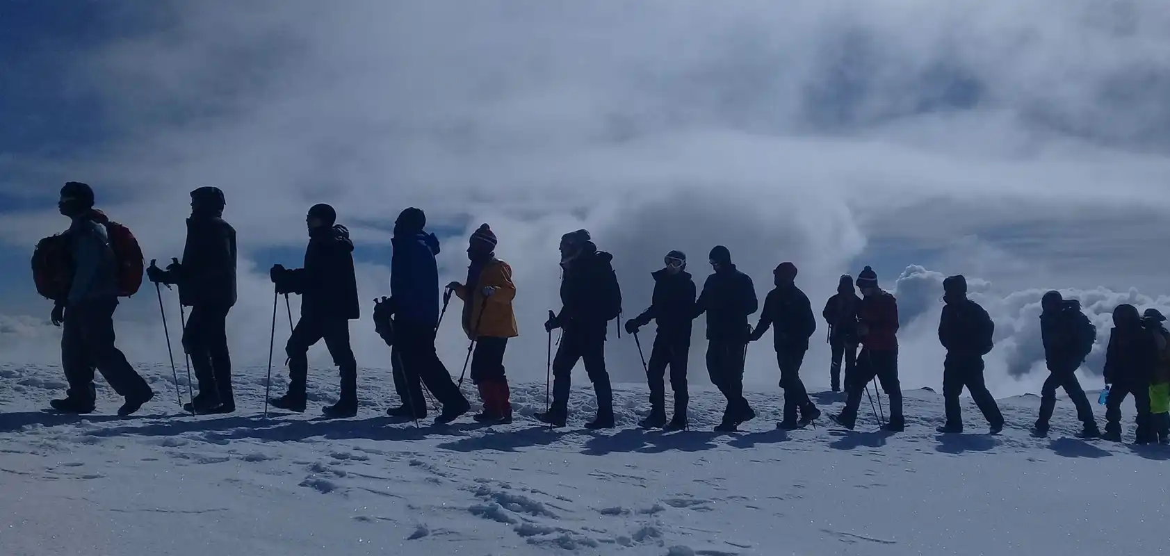
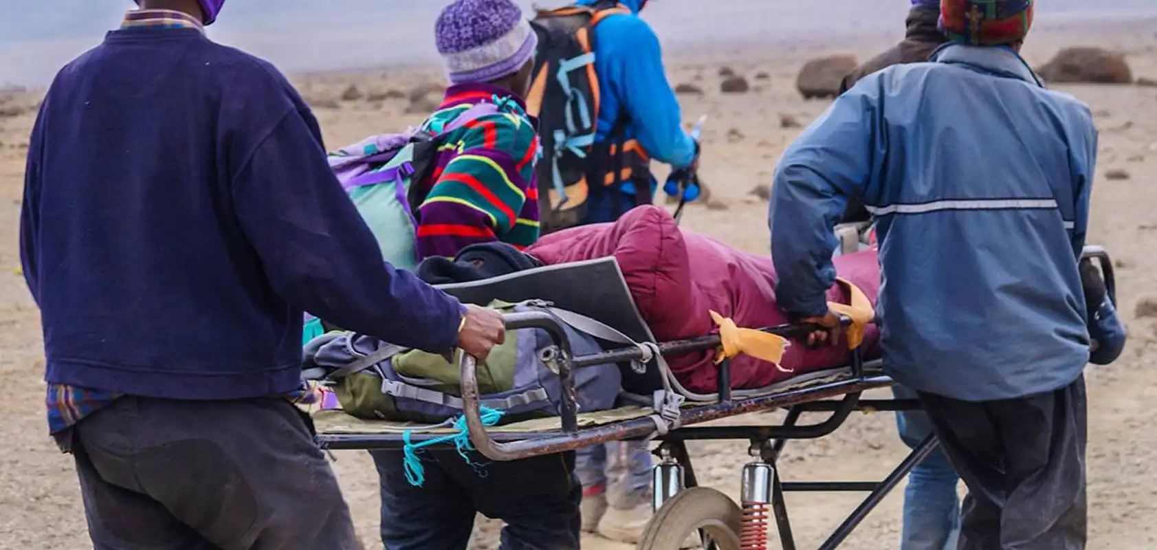
Excitement is building as morning comes with an early start between midnight and 2 a.m. This is the most mentally and physically challenging portion of the trek.
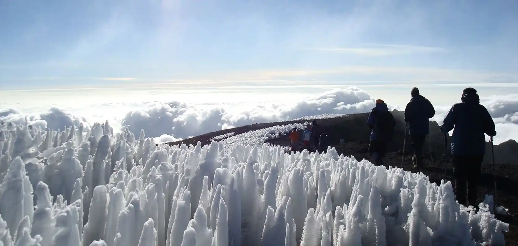
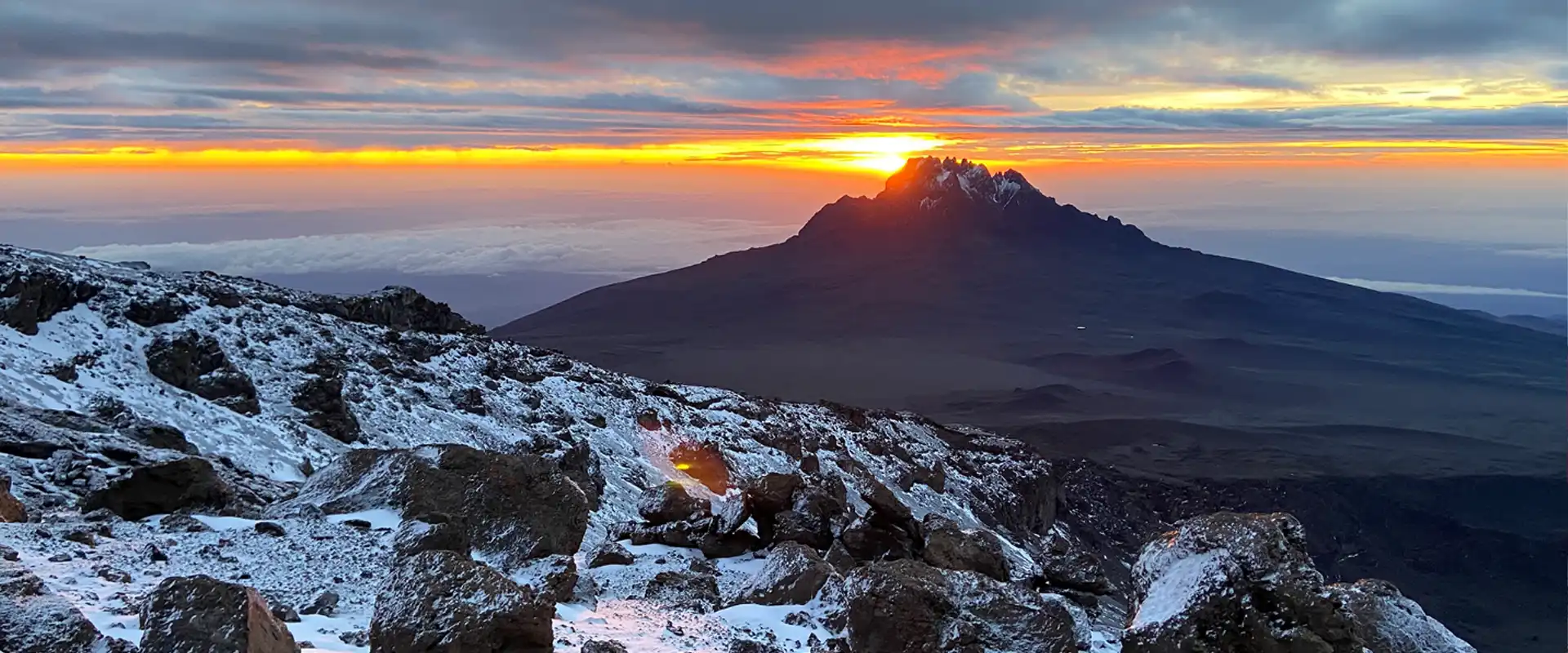
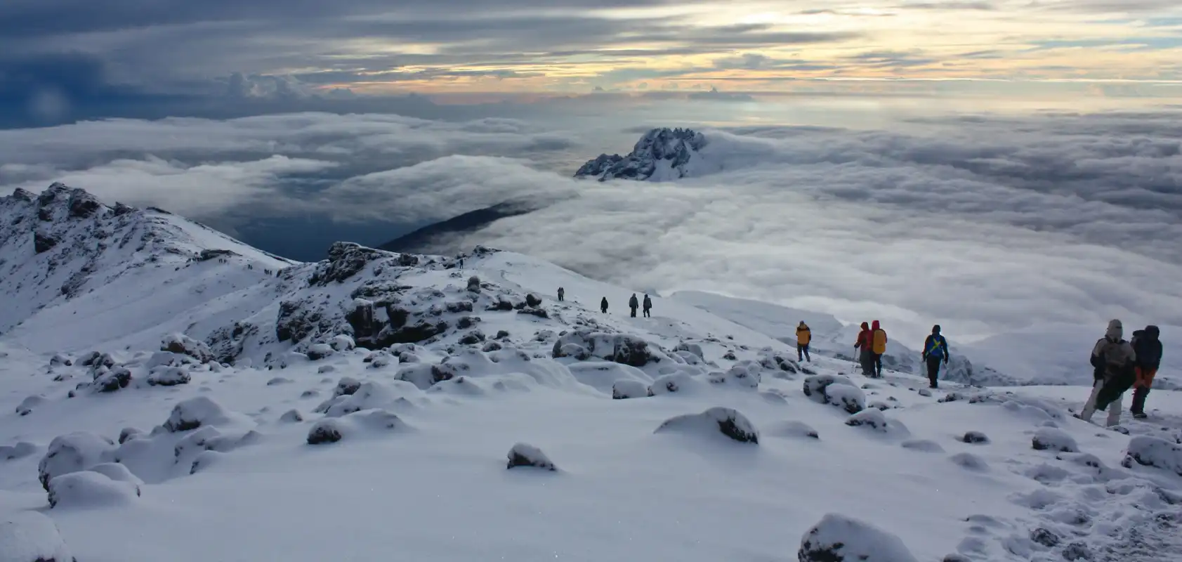
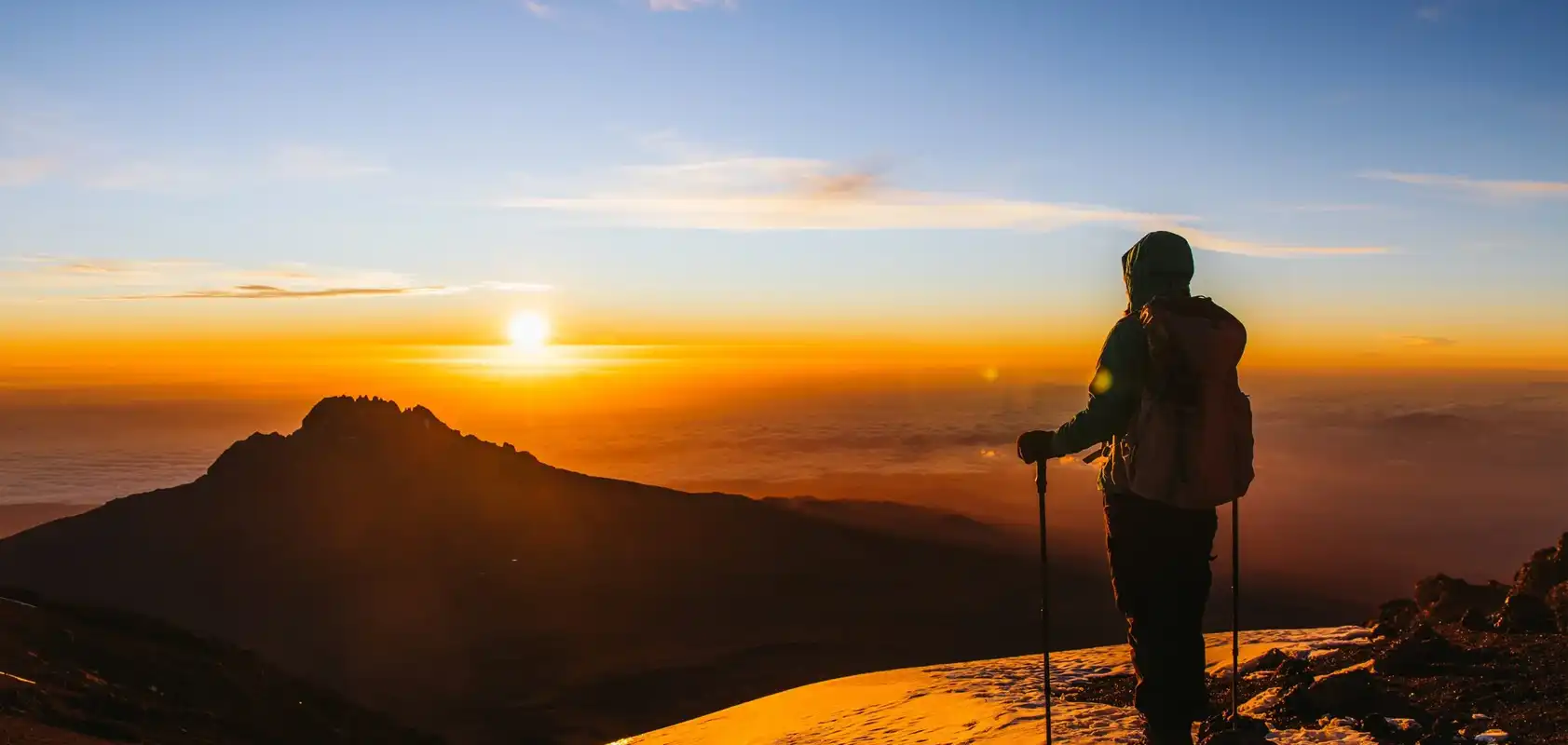
We continue our way to the summit between the Rebmann and Ratzel glaciers trying to stay warm and focused on the amazing sense of accomplishment that lies ahead. With a switchback motion in a northwesterly direction and ascend through heavy scree towards Stella Point on the crater rim. You will be rewarded with the most magnificent sunrise during your short rest here. Faster hikers may view the sunrise from the summit. From here on your remaining 1 hour ascent to Uhuru Peak, you are likely to encounter snow all the way.
Congratulations, one step at a time you have now reached Uhuru Peak the highest point on Mount Kilimanjaro and the entire continent of Africa!
After photos, celebrations and maybe a few tears of joy we take a few moments to enjoy this incredible accomplishment. We begin our steep descent down to Mweka Camp, stopping at Barafu for lunch and a very brief rest. We strongly recommend gaiters and trekking poles for uncooperative loose gravel and volcano ash terrain. Well-deserved rest awaits you to enjoy your last evening on the mountain. Overnight Mweka Camp.
DAY 7: MWEKA CAMP – MWEKA GATE – MOSHI: 9.1km/5.7mi |3-4hrs | Rainforest
Elevation: 3106m/10,190ft to 1633m/5358ft
Altitude lost: 1473m
After breakfast and a heartfelt ceremony of appreciation and team bonding with your crew, it’s time to say goodbye. We continue the descent down to the Mweka Park Gate to receive your summit certificates. As the weather is drastically warmer, the terrain is wet, muddy and steep and we highly recommend Gaiters and trekking poles.